Maggi Kelly
Dr. Kelly is a Professor and Cooperative Extension Specialist in the Environmental Science, Policy and Management department and affiliated Professor of Geography at UC Berkeley. She is an accomplished innovator in geospatial data, analysis and visualization. Dr. Kelly is dedicated to bringing cutting-edge mapping technology, training, and research support to students, staff, faculty, and the public. Her group uses a range of geospatial data and analytics – from spatial modeling, remote sensing, drones, lidar, historical archives, surveys, participatory mapping, and the field (although not always at the same time!) – to gain insights about how and why California landscapes are changing, and what that change means for those who live on, use, and manage our lands. Her work enables interdisciplinary collaboration, data-rich analytics research, and active outreach across a number of scientific domains (forests, agriculture, wetlands, climate change) with significant societal impact.
Dr. Kelly is very conscious of the speed at which our geospatial field is evolving, making the need to consume information from, and share information with broad scientific, regulatory, and public communities increasingly important. To that end she seeks to build a community interested in applied geospatial research and outreach locally at UC Berkeley and across the state. Dr. Kelly is faculty director of the Geospatial Innovation Facility and Director of the ANR Statewide Program in Informatics and Geographic Information Systems (IGIS), both of which are dedicated to bringing cutting-edge mapping technology to the ANR network, students, staff, faculty, and the public. The GIF/IGIS host workshops, conferences, and geolunches.
The Interwebs: CV / Google Scholar page / Research Gate page / Mendeley page / Twitter page. A cool interview from the Women in GIS website.
Latest News
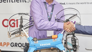
 Take Flight at FIRA-USA 2024: Join Monterey Bay DART’s Drone Pavilion!April 10, 2024 - 5:14 pm
Gear up for takeoff, drone innovators! Monterey Bay DART is is pleased to announce its partnership with HawkTower and to once again host a premium drone pavilion during the FIRA-USA event October […]
 Soar into the Future with a DroneCamp Scholarship!April 10, 2024 - 3:37 pm
Are you passionate about drones and their potential to change the world? This blog post is for you! The Monterey Bay DART DroneCamp Scholarship Program is offering financial aid to […]